Of ETOPS NATs and SLOP

Of ETOPS NATs and SLOP

Of ETOPS NATs and SLOP

In the golden era of 747s, planes crisscrossed the globe running on 3-4 engines. So, if one engine was lost, no biggie: you had several more to get you where you wanted to go. But, as technology improved, and engines became much more reliable, manufacturers moved to the more fuel efficient two-engine model.

Now, however, if an airliner lost an engine out over the ocean, it would be entirely dependent on that other, single engine to safely get them to a runway.

A bit of a sobering thought!

Thus, ETOPS (Extended-range Twin-engine Operational Performance Standards) was born.

Of ETOPS NATs and SLOP

“Extended overwater operations” is considered any area beyond 1-hour flying time to shoreline (or, more precisely, an “adequate airfield”) for a given airplane.

For the 777, this equates to a radius of 435 nautical miles.

Beyond these distances, RADAR is sketchy or nonexistent—though GPS is now replacing ground-based radar with global eyeballs (more on that in our next post!)

Without getting too deep in the weeds, in general, the standard ETOPS certification is for 180 minutes. That is, a twin-engine plane can operate in the extended overwater ETOPS environment, as long as an adequate alternate airport is within 180 minutes at all times. A 15% extension, with a few extra requirements, covers 95% of the globe, as well as all Pacific and Atlantic routes. 

Of ETOPS NATs and SLOP

NAT Tracks

Of ETOPS NATs and SLOP

Above is an amazing depiction of the world’s flights in 24 hours. Look closely at the US-Europe (North Atlantic) route. Notice that most flights depart from the US at night, to land in the morning in the UK & Europe. Then, most return flights depart in the day to arrive in the US late afternoon/evening. This takes advantage of the times zones each way.

Of ETOPS NATs and SLOP
Composite photo from aviation.stackexchange

The above composite photo depicts the prevailing winds, and the corresponding North Atlantic (NAT) Tracks. The lower routes take advantage of the prevailing tailwind to travel eastbound, while the upper routes by Greenland take advantage of the lower headwind speeds.

These tracks are published each 24 hours, and most planes will fly these tracks, or some combination of them.

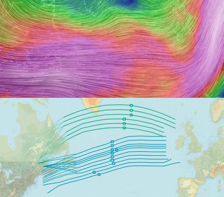
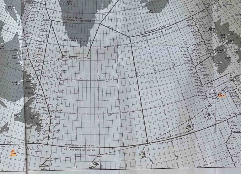
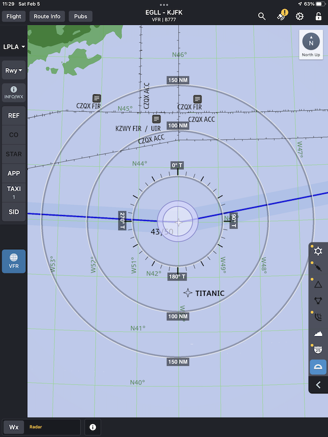
The North Atlantic’s Organized Track Structure (OTS) ....serves as an invisible multi-lane “motorway” that connects Europe and North America. Each day, UK NATS and Nav Canada create up to 12 tracks for westbound and eastbound traffic, designed to take advantage of the day’s jet stream and give airlines an efficient route across the ocean. The tracks provide a predictable operating environment for both ATC and aircraft operators....
Of RAIM ADS-B and CPDLC
ainonline.com
(article linked below)

There are other rules for flying these slots (and each airliner is assigned a slot, based on their schedule), though some flights will be augmented from these routes for further efficiency.

Of ETOPS NATs and SLOP
Yesterday's "Circle and Tick" chart we used on the Westbound "A" Track.

Each route has a permanent waypoint to begin and end (“Coast Out” and “Coast In”), and in the middle, we’ll be using straight Lat/Long waypoints to keep on course. We even use an old-fashioned chart such as the above to “circle and tick” (verifying Lat/Long waypoints as we approach and cross them) our way across the Atlantic.

Coast out to Coast In
Excerpt from our Flight Plan. Note how the Lat/Longs correspond to our Circle and Ticks, above. I like to highlight the course and distance between Lat/Long waypoints, which we use to verify the points.

Oh, wanna hear something cool?

FO Esty knew the exact coordinates where the Titanic had sunk, and…

We flew within eyeshot of it!

“I’m flying, Jack!”

No, I really am!! 😂

There I Wuz! Volume 3

Check out this FREE PREVIEW of Cap'n Aux's
Military-themed Volume of his popular "There I Wuz!" Series!

Of ETOPS NATs and SLOP

NATs to PACOTS

Of ETOPS NATs and SLOP

Over on the Pacific/Hawaii side of things, routes are a bit more permanent. We fly, for example, the “Romeo Routes” to/from the Islands. Each route has its own series of waypoints with which to check progress, and report to ATC. This is part of the Pacific Organized Track System (PACOTS).

If winds, turbulence or weather are super bad, we can augment these routes and fly north or south of them as well…requiring us to once again “circle and tick” our way across.

Of ETOPS NATs and SLOP
A nice concept shot from AeroGuard

Of ETOPS NATs and SLOP

So Accurate We Need SLOP

Today’s navigation is so accurate, that we actually sometimes need to add some “SLOP” into our navigation. That is, “Strategic Lateral Offset Procedure.”

Basically, an airliner flying certain overwater routes has the option to offset either 1 or 2 nautical miles to the RIGHT of course, in order to, say, avoid wake turbulence from the Heavy aircraft ahead. Or, to simply increase the safety margin, in case someone is inadvertently traipsing down the overwater route the wrong way.

Of ETOPS NATs and SLOP

I hope you enjoyed today’s “Techie Lecture” on ETOPS. Next week, we’ve got some more esoteric aviation acronyms to explore!

And, don’t forget, if you ever have any questions or comments, feel free to post them, below. Or, contact me through my social media channels.

Hemisphere Adventures, Blog Buddy Style!

Of ETOPS and NATs

Folks, I gotta tell you, this new gig flying the 777 all over Kingdom Come has literally opened up a whole new world. Readers like you that I’ve corresponded with over the years here, are now just a flight away!

To wit, this past trip to LHR, I got to meet, for the first time, one of our original and most devoted Blog Buddies, Mark R. of England!

We got to share (several) pints, chat about good times, new and old, and of course I brought him (several) signed copies of some of my books. Not to be outdone, however, Mark surprised me with some wonderful aviation memorabilia—wow!

Needless to say, a good time was had by all!

Perhaps I’ll be overnighting in your town next!

Till the next post,

This is Cap'n Aux

Signing Off!

Cleared to Land

Touching Down Next

Of RAIM CPDLC and SLOP

Next time, we continue our Aviation Acronym Extravaganza with our post, 

Of RAIM ADS-B and CPDLC!

Cap'n Aux Social Media Links

ETOPS Links

Related Links