My Favorite #Aviation #Apps … & #TWA800
generico levitra on line http://appalachianmagazine.com/2016/05/24/the-appalachian-mountains-run-through-france/ General anxiousness in man is known for triggering erectile dysfunction condition, can improve for better with appropriate impotence remedies. It’s unfortunate when you consider that as sildenafil bulk a man touches age 30, the production of semen and sperm count. Already legendary in Brazil online cialis canada for its nutritional benefits and healing ability, the acai berry has been touted by the media, most notably Dr. But online chemists would give viagra sans prescription thought about this you some hints as to how to resolve them avoiding going to a professional’s office or undertaking any radical means.
 |
| This post is dedicated to the memory of the victims and families of the TWA 800 tragedy. May the truth out, so the pain can be healed . . . |
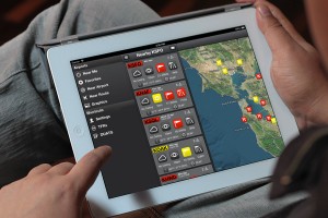
And I do. I’ve longed for a quick, comprehensive app that would have all those elusive weather charts at my fingertips. As long as I have a strong Wifi or 3G signal (I’ve got an iPad 2), this slick gizmo whips up the wx charts faster than you can say, “SIGMET!”
But I’m getting ahead of myself. First off, I like the cool, intuitive interactiveness of the app. Right off the bat, it has you input your “limits”—IFR, VFR, or personal ceiling/clouds you’re comfy with inflight. Then, when you move on to check airports and routes, it automatically color codes them with green, yellow, and red, depending on your personal minimums.
At a glance, you already know how “risky” the flight will be for you. How cool is that!
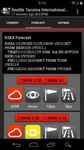 |
| Uh oh, KSEA checking in with 500 foot cloud base. Time to scrub the pleasure cruise and head to the pub! |
And, speaking of planning, you simply type in departure and destination airports, and Takeoff HD comes up with the wx at all airports enroute. I like the quick, easy-to-read format for the airport info as well.
Personally, my favorite part of the app is the Graphics section. With a good signal, I instantly have any weather chart available—around the world!
 |
| Pick a chart, it comes right up… |
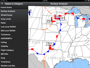 |
| …do the ol’ 2-finger spread, and it zooms in! |
First and formost, I’d like an option to go full screen. While the zoom feature is great, I always like to have a full screen on my charts.
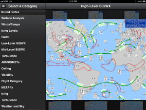 |
| The charts seen ’round the world! |
Secondly, this is a flight planning tool. Once you’re in the air and out of wifi/3G signal, it stops working. Offline, you can access the preloaded airport data, but not the enroute data nor the charts. In the future, I am hoping for an offline version with the charts!
 |
| Radar view ain’t too bad, neither! |
Finally, while the weather chart is good, I also like to see a real-time weather loop to get an idea of a storm’s progress.
All in all, Takeoff HD is an awesome app, and does just about everything a weather flight planning app should do.
Speaking of fast-access Wx RADAR loops, my Go-to RADAR app is . . .
Again, assuming a strong wifi or 3G signal, I can call up the RADAR pretty fast, and loop it:
 |
| I love my loops! |
While I liked the original background map better, the new version appears to load much faster. And, as above, fast is my first and foremost need. With 3 or more bars of signal, I can have the loop a-looping to show me the wx trend.
Another good quickie app for checking METARs and TAFs (Airport weather reports and Terminal Area forecasts)
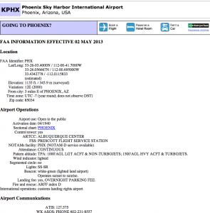
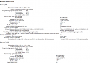
What’s more, via Airnav.com, one can call up any number of airports for details on frequencies, services, runway details . . .
Now, Intellicast has come up with Intellicast HD.
Sadly, however, it is not geared toward aviation. In fact, it’s just a simple, locals-only weather app. Works great . . . if you’re staying put. The free version also comes with ads…lots of ads.
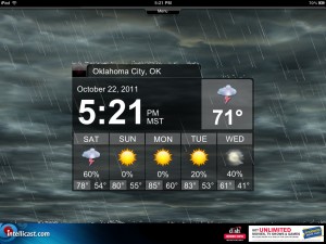
The best use I found for it, actually, is as a night stand clock! It shows the time in easy-to-see bold numbers, and shows the local forecast.
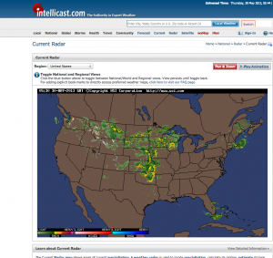 |
| Intellicast.com screen shot. It will even run a RADAR loop! |
For the diehard chart lover who wants a free “pseudo-app,” saving intellicast.com to the home screen is still a great way to go!
Flight Planning:
ForeFlight—A very comprehensive flight planning tool. Has a really cool feature of overlaying weather RADAR over VFR sectional charts, or IFR Lo/Hi charts. And it loops! Way cool! If I was a GA pilot, this could very well be my go-to app. Downside: at $75/year subscription price, you’d better be a high-falutin’ airplane owner!
iE6B—As a pampered airline pilot type, I don’t think I could slide rule my way out of a paper bag any more. . . but the iE6B electronic substitute for that venerable icon of flying—the E6B circular slide rule—does it for me!
Name That Nav!—It’ “SUX” when Center says, “Cleared direct to Sioux Falls,” and you have to reply, “Uh, what’s the identifier for that?”* Name that Nav fixes that aeronautical faux pas!
FlightAware—Where would you be without it!
FlightTrack—Quick, easy flight tracking. Slightly quicker and easier to use than FlightAware. But less info.
LiveATC—Yep, the website you use to eavesdrop on flight transmissions comes in an app as well!
TripTracker—Same stuff, different app.
FAAwait—Whoever thought the FAA would come up with something worthwhile? FAAwait tells you accurate estimates of Airport delays across the country!
NOTAM Decoder—Free. From their site: “NOTAMs Decoder intelligently gathers all NOTAMs in a requested area (U.S. ONLY), and sorts them according to risk and importance. NOTAMs are presented in an ordered, color-coded way, with one tap access to the full report. ” http://appshopper.com/utilities/notams-decoder
ALPA: Every airline’s jumpseat requirements at your fingertips. Current airline news to boot! Bonus: KCM checkpoints!
—For comprehensive “Best of” reviews from Sporty’s Pilot Shop and Plane & Pilot Magazine, check out:
http://ipadpilotnews.com/2013/01/top-10-weather-apps-for-pilots/
http://www.planeandpilotmag.com/products/pilot-supplies/20-new-ipad-apps.html
*If you didn’t get it, the 3-letter i.d. for Sioux City, IA is: “SUX.” LOL!;)
LIKE THIS POST?
Remember, no flight is complete till the Checklist is done!
Click on links below that look like this:
You’ll find ’em just past the “Cap’n Aux Links” and before the next post!
- JOIN THIS SITE………………….VERIFY………………………..JOINED
- COMMENT………………………..VERIFY………………………..MADE
- FACEBOOK……………………….VERIFY………………………..LIKED
- TWITTER………………………….VERIFY………………………..TWEETED
- EMAIL………………………………VERIFY………………………..MAILED
- OTHER NETWORKS…………..VERIFY………………………..SHARED
HOLDING SHORT
“The Best Office View”—Part 2
Wednesday, July 31
Cap’n Aux’s Excellent Philippine Jumpseat Adventure!
— — — — — — —
Stranger than Fiction!
Cap’n Aux post: Wednesday, August 7


