Ladies and Gentlemen, from the Flight Blog, this is Cap’n Aux speaking.
Welcome aboard our trans-Atlantic oceanic flight, as we travel from New York’s JFK Airport (JFK) to London Heathrow Airport (LHR)!
But first…
Happy National Aviation Day!
August 19th is official National Aviation Day. All weekend, there will be activities at your local airport.
So, get out there and FLY!!!
National Aviation Day holiday was established in 1939 by Franklin Delano Roosevelt, who issued a presidential proclamation which designated the anniversary of Orville Wright's birthday to be National Aviation Day (Mr. Wright, born in 1871, was still alive when the proclamation was first issued, and would live another nine years).
And now…
aNATomy of a NAT Flight
How Do Airliners Cross the Atlantic?
Since this time we’re not flying all the way to, say, Delhi, but we’re simply hopping over “The Pond” (as we like to call the mighty Atlantic), we’ll only need a crew of three: a Captain, First Officer, and FB, or Relief FO.
In fact, JFK-LHR is short enough (5-6 hours) that we could actually get away with a 2-Pilot crew. However, to play it safe in case of delays, we’ll typically fly a 3-Pilot team.
In this post, we’ll apply this knowledge to an actual flight, viewing the Atlantic crossing from the Pilot’s perspective. What work goes into it? What makes it different from, say, flying across the Pacific to Hawaii or Japan?
Read the Aviation Fiction Book that started it all—an
Amazon TOP 100 Breakthrough novel!
"You won't want to put it down while the midnight sun still shines!"
Airways Magazine
Official Review
Click below to read a free sample!
A Flying and Aviation History Best Seller 2022!
aNATomy of a NAT Flight
The Paperwork
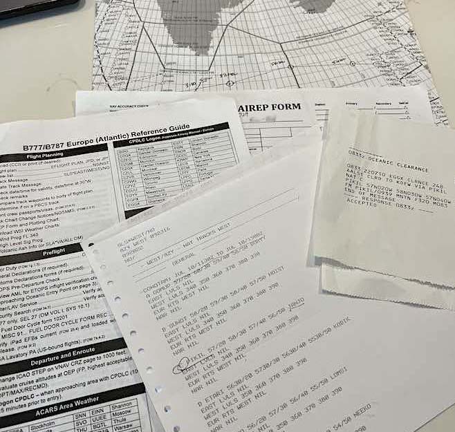
About an hour before our flight, I’ll meet my flight crew in Ops to grab the paperwork.
A normal flight’s paperwork mainly consists of the “Dispatch Release.” This is the general flight plan that has been filed with the FAA by our Dispatcher. It will include all the data, such as route, fuel burn, and weather reports and forecasts. This can all be printed out on paper, or simply downloaded electronically to our EFB (Electronic Flight Bag).
On a NAT flight, however, we’ll need a few extras:
Europe/Atlantic Reference Guide
North Atlantic Plotting Chart
AirRep Form
FAA-issued NAT Tracks Report
An Oceanic Clearance (In addition to, and separate from, the main ATC clearance.)
Let’s go through these as we need them.
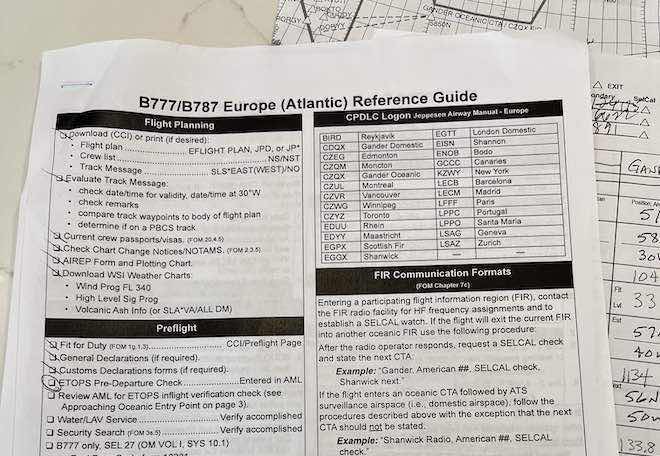
Up first, our B777/B787 Europe (Atlantic) Reference Guide.
This is a very detailed, step by step Checklist, which will help us to safely—and legally—navigate across the Atlantic. Extras such as anticipated frequencies, and contingency plans in case of issues or emergencies, will also be spelled out in the guide.
Don’t leave home base without it!
aNATomy of a NAT Flight
Plot Us A Course, Mr. Sulu.
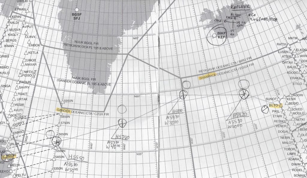
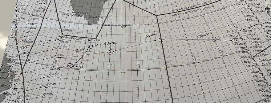
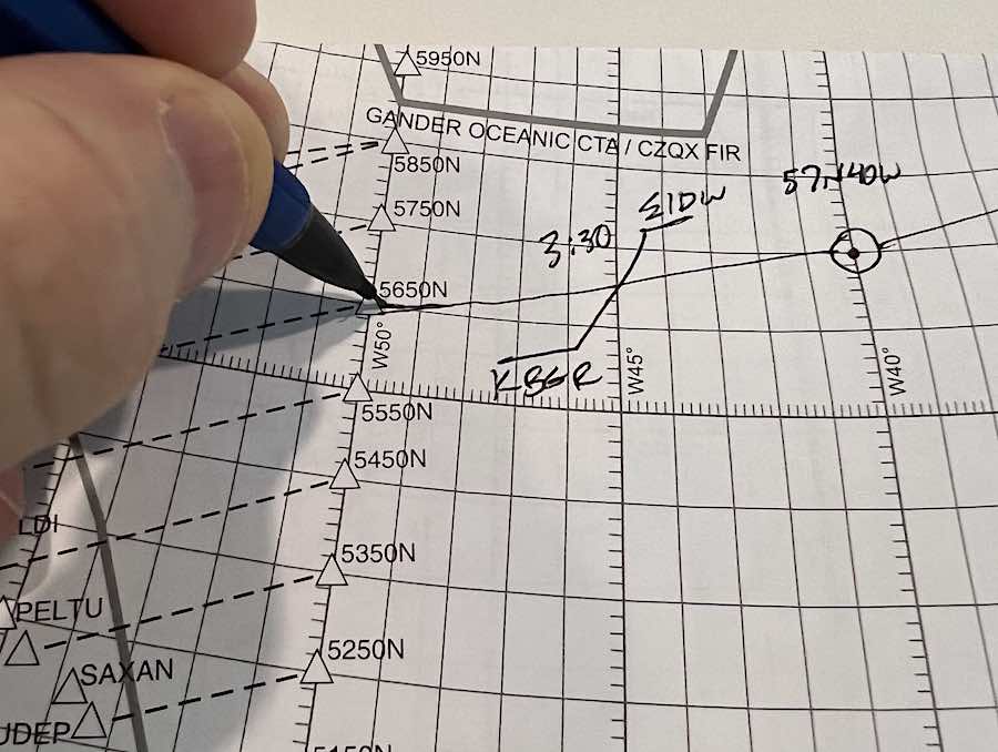
While still in Ops, we’ll gather ’round the ol’ plotting table, and, with pencil and protractor, literally draw out our course on the North Atlantic Plotting Chart.
This is a bit of a superfluous throwback to the elden Pan Am Clipper days, but is still required by the FAA to plot out. Besides, it’s a quick, easy pictorial representation of our flight to reference.
Let’s take a closer look.
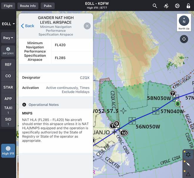
Notice how, in the example below, As we “Coast Out” over the Atlantic, we go from fixed, pre-named waypoints (Peltu, Saxan, etc. on the left), to another fixed waypoint with no name, but a Latitude/Longitude designation.
In this example, we’re plotting a course that starts from “Janjo” waypoint (hidden by my hand), to 56° North, 50° West.
Note the shorthand for this Lat/Long: “5650N.”
Next, we plot the rest of the route over the Atlantic, which is not pre-established waypoints, but simply more Lat/Longs. In this example, we can see the next point is 57°N, 40°W.
On a Side Note, the “KBGR/EIDW” line I drew in is the approximate location where, in the event of an emergency, I and my crew would choose to divert to either KBGR—Bangor, Maine, to the West—or to EIDW—Dublin, Ireland, to the East. (Again refer to our ETOPS post.)
These airports are just a pre-planning suggestion. Other factors, such as weather and services, would come into play when deciding on the actual diversion airport in real time.
Every 5°, we’ll plot a new Lat/Long waypoint along our Pond Trek across the Atlantic.
Which brings us to…
aNATomy of a NAT Flight
The Daily NAT Tracks
Every 24 hours, a set of pre-established flight routes are published by ATC authorities.
They are designed to take advantage of prevailing winds, help avoid forecast weather and turbulence, and basically give the vast body of transatlantic air traffic a few “train tracks” along which to navigate.
Airlines, and other aviation outfits, can opt to track these routes…or not.
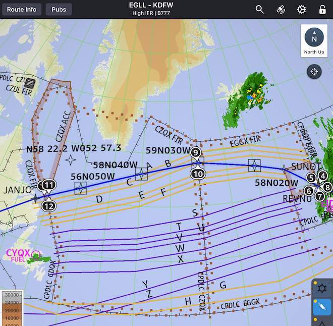
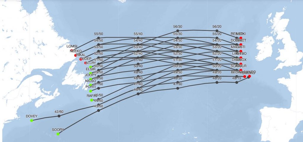
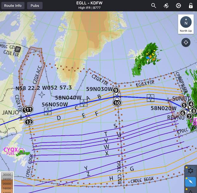
Above: The daily NAT Tracks East, good for 24 hours.
Note the Westbound filed track below.
We start by Coasting Out over the Atlantic at Sunot intersection (right), initially follow the E track to 58N/20W, then pretty much “cross the train tracks,” and end up Coasting In on the A track over Janjo (left).
As long as the route is filed, approved, and issued, that’s just fine. In fact, we’ll often fly a route far north of all tracks, over the southern tip of Greenland, simply to take maximum advantage of winds, ride and weather.
Above: West tracks A-F, then East tracks S-Z. Notice toward the bottom two more West tracks, G and H.
aNATomy of a NAT Flight
Cleared for Takeoff!
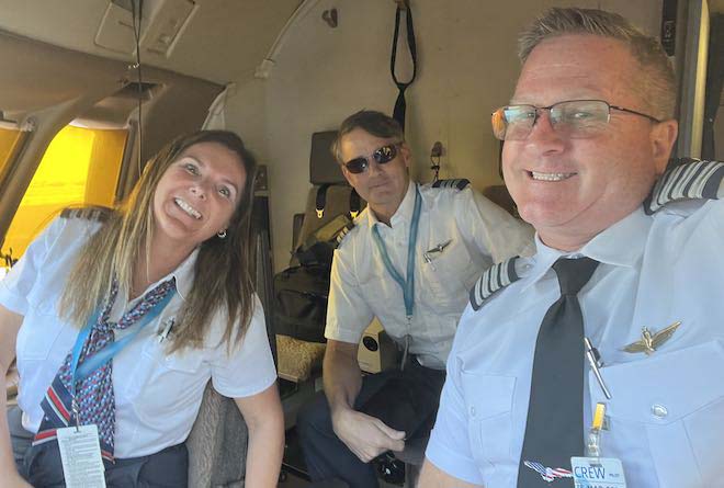
Ready to launch! FO Tammy, FB Deacon and I prepare for our trip over the Pond to Frankfurt (FRA—see our Hemisphere Dancing Report, below!)
With our main clearance filed and all required paperwork onboard, we head to the plane for launch. First, we’ll receive our main clearance for the route via CPDLC, then fire up and taxi out.
From takeoff to Coast Out, we’ll fly this just like any other flight. However, within eyeshot of our Atlantic Crossing waypoint, we’ll need that second clearance which specifies exactly which track we’ll fly over The Pond…
Most commonly, that comes via CPDLC contact with Gander Oceanic Radio, who oversees the northwestern quadrant of the Atlantic crossings.
We’ll explore in detail the crossing itself in our next post. But, for now, our First Flight Attendant is knocking at the door with our steak and lobster crew meals (OK, chicken and salad)!
Hemisphere Dancing Report
Frankfurt Mains Dancin'
Last month, I was finally able to bag a coveted FRA (Frankfurt, Germany) flight!
We had a lovely layover in Frankfurt Mains area, and of course my FO and FB were already connoisseurs of the local dining fare. FO Tammy and I both enjoyed brats, while FB Deacon wolfed down a massive schnitzel that he’d been craving all the way across the Atlantic—and then lamented that he couldn’t buy another one for “dessert” since the pub had already closed!
What’s cool about this trip is that, on my very next trip, I flew again to DEL. As we did, we crossed over FRA by night, and got a great view of the airport!
As a bonus, we caught a view of this amazing high cloud formation. It was catching the sun over the horizon (we were flying a pretty high latitude), and made for an amazing view.
It reminded me of a rocket launches I’d seen out of Vandenberg or Canaveral, and it may very well have been the remnants of a rocket launch. Not quite sure, but striking, nonetheless!
Quora Question Quorner
Wherein I answer some of your favorite questions in Quora’s aviation forums.
We’ve got so many Quool Quora Questions to answer, I thought I’d group them by theme in a couple of galleries. Click on the ones which sound interesting and enjoy!
Technonerd Quorner
Sample Q’s:
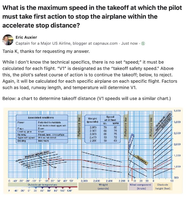
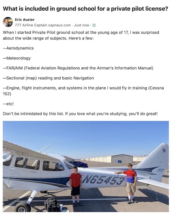
V1 Cuts; Accelerate-Stop distance; what’s turbulence?; What subjects are taught in Private Pilot Ground School?
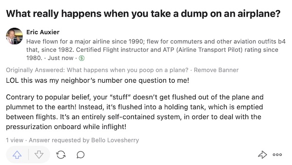
Bonus Techno Q:
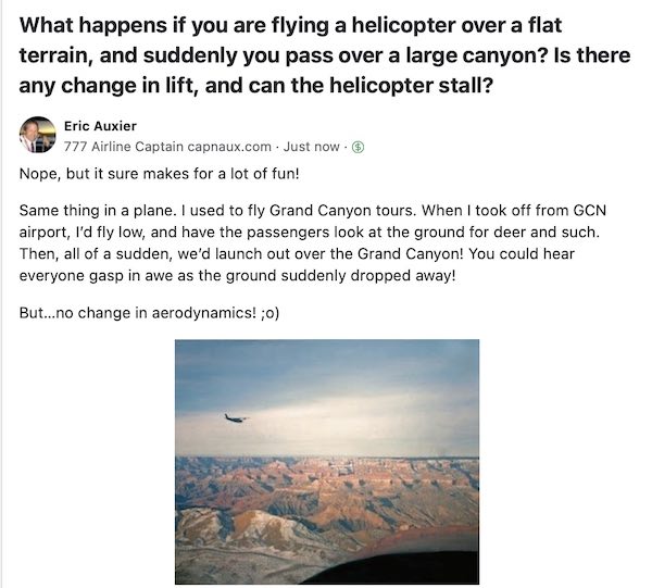
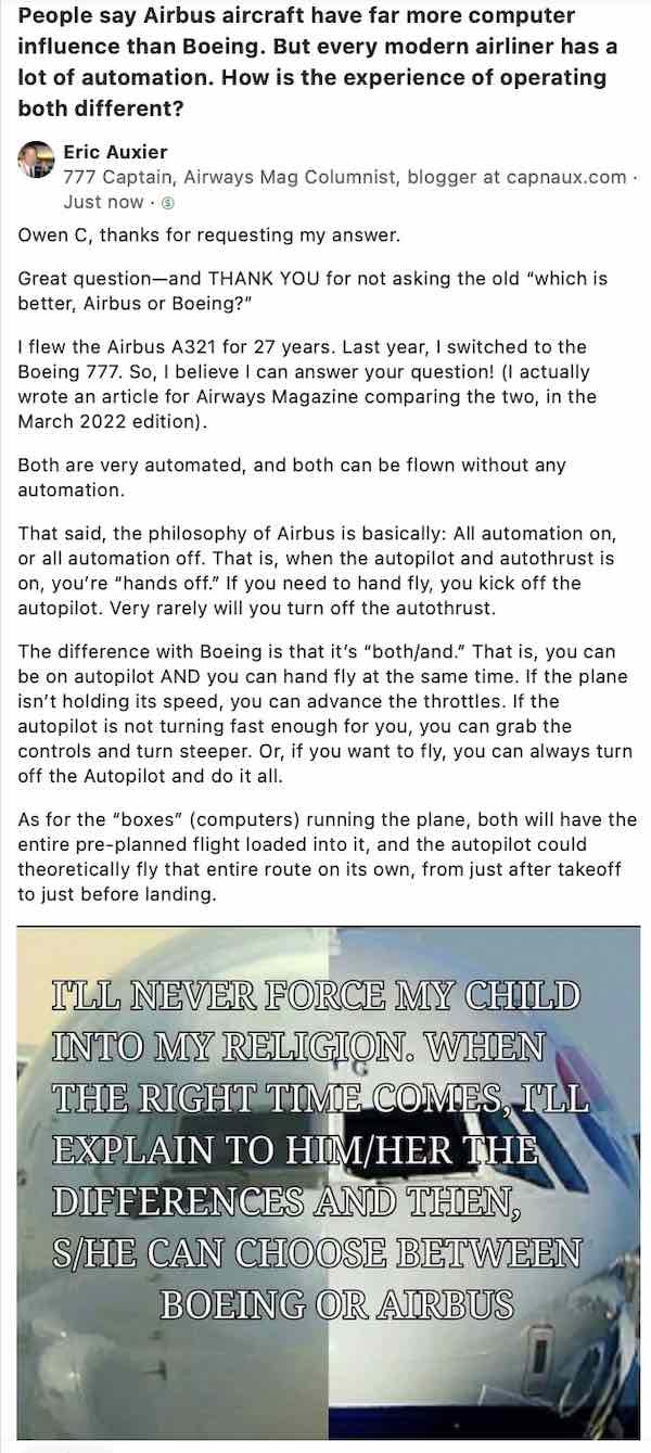
One of my most commonly-asked questions! 🙄😆💩
The Joy of Flying!
Sample Q’s:
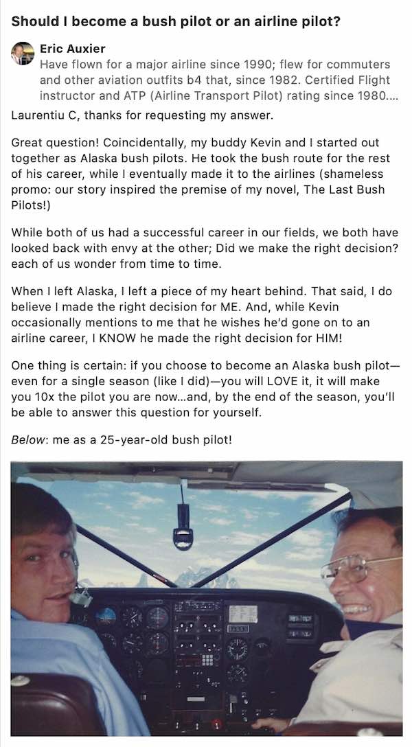
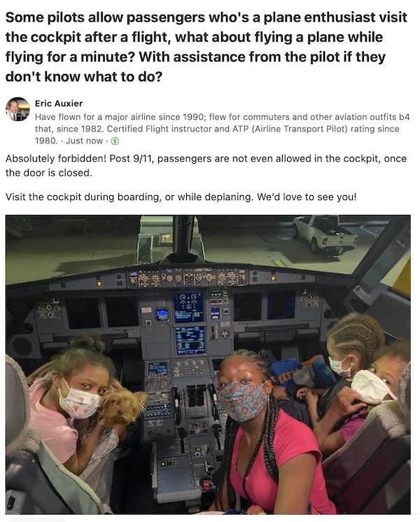
What’s your favorite plane to fly?; should I become an Alaska bush pilot?; can I fly the plane if I visit the cockpit?
Bonus Q:
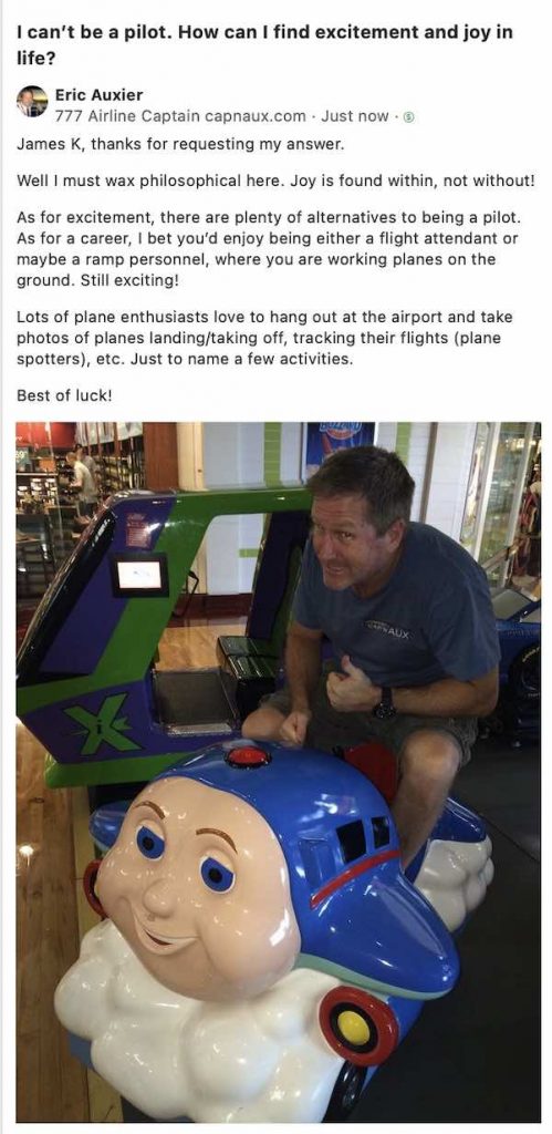
Without flying, how can I find joy in life?
And, finally, I’ll sign off below with the best Q and A of all…


